Friday, May 13, 2011

Grays Lake Blackfoot Reservoir

We had a great road trip today--our first in a really long time.  We left at 9 am and headed out to Bone, Idaho.  From there we went south to Gray's Lake and then over to the north side of Blackfoot Reservoir.  We finished up by going through the Fort Hall Reservation and then through potato farm roads back home.  The trip had all the elements we like--excitement, adrenalin, education and entertainment.

The adrenalin happened when we got stuck in a bar ditch.  The driver's side axles were buried up to their hubs in deep goo-goo.  Frankly, it looked real bleak.  We were far from help--the road behind us was blocked with at least two feet of snow and we hadn't seen another vehicle for many miles.  Luckily, our four wheel drive Zuk got us out of that jam and back on the road again.  "Hey, we're still flying--let's GO!"


We were blocked off on yet another road as well and had to take a long detour to get back to easy-going paved roads near Blackfoot, Idaho.  Along that route we paralleled the Lander Cutoff--an Oregon Trail Legend--and learned about the river access points for the Blackfoot River.  We also observed a unique geological feature for which we have no explanation.  (Pictures soon.)

When we got back to farm land, we decided to take farm roads all the way home.  I was a pleasant way to end the trip.  We arrived home at 4:45.  We traveled 164 miles.

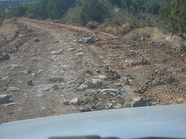
The GPS showed we were stopped a total of 1:45 on our trip and our total drive time was 6 hours.  Our actual trip speed average was 22 mph. but the average when we were moving was closer to an average of 30 mph.  There was a LOT of snow beside the roads and a LOT of water flowing every which way, including over the roads in many places.  Some spots were very greasy and some were still covered with sheet ice.  Some were still muddy and others showed signs of serious mudder action a few days ago.  The ruts could have swallowed the Zuk!  Luckily, the dust wasn't bad yet.  Traffic was light.  Between Bone and Idaho 34, we saw only one vehicle.  Highway 34 was fairly busy, of course, and we counted perhaps 20 vehicles.  Once back on dirt on Blackfoot Reservoir's North Access Road, we saw only two vehicles between Idaho 34 and the Fort Hall Reservation.

When we reached the inflow east side of Blackfoot Reservoir, we put in a HAM radio call to the Sedgewick Peak repeater.  It was 35 miles from our point of TX.  Amazingly, someone in Logan Utah, (KF7LUB) picked up our signal and we carried on a nice conversation.  That was fun.

We both totally enjoyed the trip.  Even though we were in the vehicle for nearly 8 hours, we weren't tired when we arrived home.  Susun went into the ard and started gardening.  I dug up some dandelions and then went shopping and helped fix dinner.

I spent a lot of time trying to fix the maps for this post.  Our GPS let us down on this trip.  Well, it wasn't the fault of the GPS--but the fault of the operator!  Above are the waypoints for our 164 mile trip today.  Below is a partial track map superimposed over the waypoint flags.  The GPS dropped the track about half way through the trip.  It's back to the drawing boards to find out the "why" of the dropped track.  In the meantime, we will be taking a LOT more waypoints on the next trip.  Many of the waypoints you see in the top map were put in by hand when we got home.  That's not the way it's supposed to work.  We will get better for the next trip!  You can click here for an interactive version of the waypoint map up above.  Each waypoint has at least a title and some waypoints have notes and more.

We filled the gas tank Saturday noon.  It took 5.65 gallons and cost $21.  Our mpg was an even 29!!!!  What's really odd about this Samurai is that normal city driving nets a 25 mpg.  When we are out in the boondocks driving in second and third gear, we get BETTER mileage then we do around town.  Go figure.

Sunday, March 20, 2011

Last shake down on First Day of Spring

We took SuziQ out for a short shake down this morning.  We left home and drove The Well Road (FR 119) to FR 618 and then over past Sacred Mountain to the Deadwood Road.  That's just before (west of) Walker Creek.  We headed up Deadwood until we got to a series of volcanic ledges that were just slightly beyond a stock Zuk's capabilities.  We would want at least 2 inches of lift, skidplates and rock rails to attempt those ledges.  Anyway, we got in some nice maneuvering in a lot of SOB rocks (SOB = Same Old Basalt rocks).
The road leading up to the rocky parts was heavily eroded and rutted and stretched out our stock articulation.  Nothing shook loose aside from some body panel clips.  The newly installed hardtop didn't flex and was dust free on the very dusty FR 618.  We are running 10 pounds in the General Grabbers and they handled the washboards real nicely.  The tires did a fine job on the SOB rocks, too.  Susun drove it back down the hill and home and she's as happy as I am with this rig.  We'd like to get some skidplates soon but, if we don't, we're good to go wheelin' on some classic Arizona and Utah back roads and trails on our way up north to Idaho in mid-April.  Life is good!  Cheers, jp

Sunday, March 6, 2011

Sycamore Pass & Robber's Roost

It's been exactly 30 years since I was out at Sycamore Pass & Robber's Roost.  Back then you could drive right to the pass.  It's blocked off now and you have to hike out there on what's called the Dogie Trail.  The Forest Road out to the Pass is well maintained and any old sedan can make it easily.  The road out to the pass now serves as a kind of feeder route to an extensive network of various roads rated Moderate, Difficult and Extreme.  See the blog post below this one for more information.

On the way back from Sycamore Pass, we turned north on Route 9530 to go to Robber's Roost.  The Forest Service rates 9530 as Difficult but it wasn't difficult at all.  We did use our 4WD but only to go a little slower over the rough cobbled surface.  Anyway, we got out close to Robber's Roost and decided to hike to the top of it.  Here is a photo of the Coconino Nat'l Forest map that shows Robber's Roost in relation to Sycamore Pass.
Luckily, when the gubmint made that big Wilderness area, they somehow squeezed  #9530 into a little neck of non-wilderness.  That's a good thing because they don't let vehicles into Wilderness areas.  We really enjoyed our 90 minute scrambled up and back on Robber's Roost.  As Susun like to say, "It's a comeback spot."  The sweeping view of Red Rock Country is real nice.  Door-to-door, our run was 66 miles.  Most of that was on pavement getting over to Forest Road 525 between Sedona and Cottonwood.  The map below shows the portion of the run from Highway 89A out to the Pass and the Roost. The second map shows the area of the Pass and the Roost in a little finer detail.  We parked at the red "X" so the rest of that GPS track is on foot, not in the Zuk.

 We thought about checking out Road 9530B but came to a small hill that definitely required skid plate protection.  We sure want to get some skid plates soon!  Road 9530 proceeds past Robber's Roost on up a steep hill to some old mining roads.  Those stretches appears to be beyond the limits of a stock rig.  Below are a few more photos of our hike up onto Robber's Roost.
We were out for six hours but moving for only four of those hours.  The way the GPS works, "moving" includes the time we were hiking.  So, the actual driving time would have been about 2.5 hours.  Our gas mileage dropped down a little bit on this trip to 26.6.  Trip cost was $8.46 with gas at $3.40 here.
 Our original goal for this run was the road that goes up on top of Sugarloaf.  In the photo above, Sugarloaf is marked with the "A."  You can barely make out the Zuk parked at "B."  That's Black Mtn. behind Sugarloaf and Mingus Mtn. way in the back far horizon with snow on it. We hope to get back out there again soon to do the Sugarloaf run.  There's a lot of really intriguing roads in that vicinity.  I suspect we're are going to be regular visitors there.  You can click here for the interactive Google map.

Cheers, jp

Verde Valley Wheelin' Roads?

Saturday, Susun and I drove out to Sycamore Pass and Robber's Roost. That run is described in the blog post above this one. This was our first experience with the OHV road and trail system the Coconino Nat'l Forest put in place in 2005.  They have put up at least one cool new sign (so far it's not shot up) showing the roads in this vicinity.

There's a couple of maintained roads that provide access to the maze of all the other routes. Smoky has classified the roads from easy to extreme and they are all color coded on a signboard map. They sell a six dollar map that I plan to buy either today or tomorrow. This large area appears to have the potential to be a real playground for Zuks.

This is one area where camping is allowed on the Forest.  There's a huge chunk of land around Sedona where all camping is prohibited unless you go into a developed campground.  I picked up the camping map and OHV map ($6) today in Sedona.

This might be a great place for a ZOA annual spring camp trip. The photos below are pretty self explanatory.  We will post up more here when we learn more.  (You can click on any image below to see a larger version.)
We definitely plan on spending more time in this area.

Friday, March 4, 2011

Blue Grade & Stoneman


After being gone 19 days, one of the first things Susun wanted to do was a road trip in SuziQ. We arrived home late Wednesday and were packed and ready to run by 11:30 Thursday morning. We headed back up the Blue Grade on the same route as our first run in Suzi Q on January 27th. This time, though, we pulled out at the cinder pit alongside Rarick Canyon. We spotted the elusive distant waterfall alongside Table Mtn. in Mullican Canyon and decided to attempt to get over there to see it.

When the Blue Grade ended at the paved Stoneman Road, we were somewhat surprised to see a "Road Closed" sign. The Blue Grade had been bone dry for us, even dusty in places. We figured the Forest Service put up the closure sign when the road was still a pig sty of mud.

When we reached the "T" in the Stoneman Road, there was another "Road Closed" sign for the route to Watershed Camp and Apache Maid Mtn. Since the previous Road Closed sign hadn't been necessary, we figured maybe the same thing was true for this closure sign. Wrong. Barely a couple of miles out on the Watershed Camp Road, it turned to total sticky, greasy, deep slop. We could easily see that the shoulders where black holes waiting to swallow a Zuk alive. We carefully and gingerly turned around and slip and slid out way back out to a firmer surface. At one point, our tires were basically as smooth as bowling balls with all the volcanic mud stuck to them. We enjoyed a nice snack break at one of the tributaries of Rarick Canyon.

We next figured that the main Stoneman Road would be passable since it gets a lot of traffic and serves a place where people actually live year-round: Stoneman Lake.
Sure enough, the Stoneman Road had been expertly plowed and was in great shape, even dusty in a few places. A normal sedan could have traveled the road except for one really sloppy part. We stopped briefly to peer into Stoneman Lake. It's not a lake anymore. It should be called Stoneman Marsh.

As we topped 7,000 feet and kept climbing the snow became much deeper. We topped out at 7500 feet and then drove out to the end of the Stoneman Road at Forest Highway 3 and turned around. We picked out a medium-dry pull out and slapped on our snowshoes. We enjoyed a fine snowshoe out into a sunny meadow. Well, it's not a meadow now, of course, but it would be when the snow's gone. There's an impressive amount of snow up there in there in the high country.

We then retraced our route back home. The run was 58 miles from door-to-door. The "new" General Grabber tires really performed well, except in the mud. They made the ride a lot smoother and we both made numerous comments about how the tires tamed the rocks and washboards.

After returning home, we stripped out the inside of the Zuk and ripped out the OEM carpet. Carpet is impossible to keep clean when you're messing around in snow and mud. We also made a more secure mount for the 2nd spare tire. Our personal rig is beginning to come together and we are pleased.

We don't think the Watershed Camp Road will dry out anytime soon--it's that wet. Hopefully, we can get up there while the Mullican waterfall is still cranking. We've hiked to it once before and we guess it was about 60-80 feet tall.

You can click here for all 72 photos we took. We'll eventually put captions on them.  The screen shot of the track map is below.  Click here for the interactive Google Map.

The trip took 3.5 hours.  The GPS shows we were moving for 2.5 hours and stopped for an hour.  Our average speed including stops as 17 mph.  Our actual moving speed average was 24 mph. Our mpg was 28.6 and the trip cost (@ $3.40 gal.) was $7.12 for 2.1 gallons.

Saturday, February 12, 2011

The Goat Peak Trail-February 11, 2011

Trip Three was a traverse along the back side of Mingus Mtn. from Cherry to Potato Patch.  The GPS track log map above shows the route roughly from the Cliff Castle Casino to Potato Patch and then down Hwy 89A a little way toward Jerome.  The return was via normal highways and roads through Cottonwood and Cornville.  (You can click on the map above for a larger image.)

NOTE: We originally called this run "The Backside of Mingus: Cherry to Potato Patch." We changed it on February 27, 2011, to "The Goat Peak Trail." That's what it is called in the book "Backcountry Adventures ARIZONA."

We started the trip at 11:30 and returned close to 4 pm.  We saw no one from when we turned off of Highway 260 at the Yavapai County Complex until we reached the pavement again at Hwy 89A.
This is the best route for a stock Zuki.  As everyone knows, stock Zukis don't climb paved highway hills very fast.  They can really stack up a long line of traffic on a steep hill.  All of your hill climbing is done on gravel or dirt roads via this routing.  From Potato Patch, it's all down hill to Cottonwood.  Plus, the twisty-turny Hwy 89A is slow going for all vehicles.  You simply can't drive it very fast or you will have a wreck.  That means the Zuki is capable of going about the same speed as all the other vehicles, regardless of their horsepower and handling characteristics.

We often forget just how beautiful these Arizona backroads really are.  This is a wonderful back country trip for a stock Zuki.  There's just enough four-wheeling to make it interesting without being "over the top" of the stock Zuki's abilities.  The scenery is superb and there are some truly awesome lunch spots along the way.  The route goes through a really sweet older ponderosa forest near Cherry and another younger pine forest on Mingus.

One of the highlights of the route is actually driving on top of the Tapeats Sandstone behind Mingus.  It's at least a mile of this distinctive rock unit, perhaps two miles.  It's very rough, of course, but the thrill of driving atop something that sits almost at the very bottom of the Grand Canyon is awesome.

We did violate one of the cardinal rules of back country travel.  We didn't tell anyone where we were going and when we would return.  Opps!  We also didn't take overnight survival gear, food and tools.
Two peanut butter sandwiches simply wouldn't have been sufficient in case of a major breakdown!

Heck, we didn't even take duct tape.  That's a BIG No No.  The Duct Tape Gods surely take note of such antics and could have sent down severe consequences on us for such a foolish transgression.  We have been reprimanded and are serving our penance now.  We promise never to make such egregious mistakes again.

It was a wonderful trip.  SuziQ purred like a contented kitten.  The highway tires survived the sharp rocks without any signs of abuse.  Our trip rigging held up well and the various boxes and such didn't shift around.  All our personal gear is finally coming together into an efficient ensemble.

Trip #4 will have to wait until late February when Susun returns from Hawaii.  The first three trips have been very educational and instructive.  We hope to get a lot better at this game.  Gary said he will help us get a ham radio and help with our license.  That's really going to be great for peace of mind when we get back up in Idaho where cell service is scarce as a Democrat.

We're very happy with SuziQ's overall performance.  She's looking more and more like a keeper.
Our total trip length on this excursion was 77 miles.  As we approached the gas station near our home, we each guessed how much fuel it would take to top off the tank.  We both guessed 4 gallons.  Much to our amazement, it took 2.5 gallons and that calcs to 30.8 mpg!  (Yes, we topped the tank until gas splashed back out.)  This trip cost a grand total of $7.76 on $3.09 gas.  Yeah, maybe she's a keeper.

Cheers, J&S
The bulk of this run is out in the open. The road is flanked by scrub brush. This makes for some sweeping views.
I wish we would have snagged a GPS waypoint for this spot. It's a great lunch stop and it looks like there's a real nice nearby hill climb to challenge the modified rigs. It's roughly halfway through the run.
The sign says it all--the fun part of this run is basically 21.5 miles.
This is a photo of the ponderosa forest near the Mingus Summit. The other forest over by Cherry has much older trees and more species diversity.
The Garmin provides a great to log a trip. Once we get finished with our river mapping project, we will start doing waypoints on our runs and routes.

618 to Cedar Flats (Trip 2 - Feb. 3, 2011)

The weather turned nice again pretty quickly this morning. We knew it was "Road Trip Time" by mid-morning. We scurried about as fast as possible and hit the road about 11:30. We'd been talking about doing 618 to Cedar Flats and today was the day. We couldn't have picked a better day to do it. We saw one Jeep on 618 and only a grader on the Cedar Flats Road (214). The Garmin shows we were out a little more than 2.5 hours and covered a little over 40 miles round trip "portal-to-portal," as they say. We did go fill it up with gas to check out mpg and were both surprised to see the trip cost a mere $5 and netted a 26.39 mpg despite long periods in first and second gear. Our total elevation gain for the day was 4,136 feet and we topped out at 5,986 feet when we came face-to-face with the grader blade. Click here for the interactive Google Map of today's trip.
Obviously, this close encounter brought out exploration of Cedar Flats to an abrupt end!  The grader's first pass had really torn up the road and it was very slow going.  That's what we bought the Zuki for--slow going on rough roads.  We didn't get a chance to take any photos of the really rough parts because it was too bouncy and we were both holding on tight.
 It's great up on top of the Cedar Flats mesa.  You can see forever practically anywhere.  You get to peer into West Clear Creek Canyon and ponder the Blodgett Basin Trail's precarious route down.  We scooted far enough ahead of the grader to enjoy a nice lunch at the lip of the Mogollon Rim.  The photo below shows the Cedar Flats Road as it skirts the top of Blodgett Basin.  The photo below that one shows a peek of the peaks in the background over Susun's left shoulder.  "Twas a mighty fine day for a leisure cruise in our backyard here.

Blue Grade to Watershed Camp (SuziQ's first trip--January 27, 2011)

'Twas a great morning for SuziQ's maiden voyage one month to the day after we purchased her. We went wheeling up the rough Blue Grade and then over toward Apache Maid Mtn. We turned around when we came to the snow line not far past the Watershed Camp. Most of the snow has turned into pure sheet ice and we don't have the correct tires (or attitude) to deal with pure ice on an uphill in MOAN Country. We enjoyed a nice brunch of PB&J sandwiches and some cold milk Susun brought in the thermos. We saw no other vehicles during our short journey.

SuziQ performed admirably. It has the least rattles and noises of any of the other Zukis we've owned. It clearly has good compression and handles difficult spots and tall basalt rocks in stride.
It rides well and isn't nearly as stiff and bumpy as some of the other Zukis we've driven. All-in-all: a real good first trip. Now we will shake out some of the kinks in our personal rigging such as camera placement, where to stash our personal water bottles, the binoculars--all that little nit-picky stuff. We did lose cell phone signal up top so we need to get a CB radio rig onboard, too. Heck, maybe it's time to break down and get our HAM radio license.

We took along the Garmin 60Csx for an extended shakedown cruise, too. This time we set the unit to record a track of the journey to its one gig onboard micro SD card. It picked up over 600 data points for this little jaunt. The data points uploaded off the data card seamlessly. They then imported equally as easily to Google Maps and made the graphic you see above. (Click here for a zoomable online copy of the Google Map.)

Two photos below show real nice features of the Garmin. We're gonna have some real fun with that elevation change thingie. It ROX!

This was the Garmin's final test before being put into real time action on behalf of the Verde River Recreation Guide. It passed with flying colors.

Our next SuziQ trip will be a shorty on the 618 Road over to the Cedar Flats Road. After that trip, we should have the kinks out of our personal rigging. Then we're planning an all-day trip someplace TBD.

Life is good. Cheers, jp


Zuki Trip Log

We started this blog today so we will have a place to log out Zuki Trips. (ZITS).